Captain Ron shore sheet
Warnings first, because that is the job
Getting to Hvar took some sitting on our hands. On Monday 13 April 2026, while we were still up in the Trogir and Marina Agana corner, the DHMZ bulletin read jugo gusts 35 to 50 knots, local bura 35 to 45 knots on the north Adriatic and Velebit side, sea up to 5, and possible thunderstorms. Captain Ron's summary of that, verbatim, was: "That is ugly water, not a play day."
By Friday 17 April the water had calmed down and the boat's live fix was on Hvar's north coast. The morning call that day was Sealegs GO — "good day overall, light winds most of the day, a bit choppier by evening" — against a PredictWind CAUTION, with PWG and PWE showing 1 to 10 knots and ECMWF 5 to 11. Two models, two moods, one perfectly nice day. That gap is normal in the Adriatic in spring and it is exactly why you read more than one.
Quick verdict
Hvar is two different cruising problems wearing the same name. South side is Hvar Town, the Pakleni islands and the party: gorgeous, crowded, exposed to anything southerly, and you are not allowed to anchor in the town bay. North side is Vrboska, Jelsa and Stari Grad: proper shelter, real marinas, fuel, and a night's sleep. Decide which trip you are on before you plan the approach, because the wind will decide for you otherwise.
Where the boat actually was
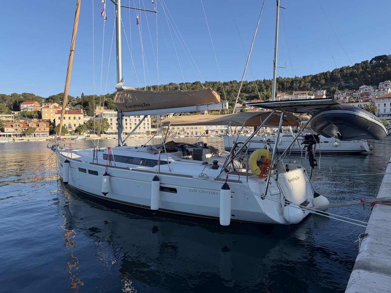
Our fix, 43.1785°N, 16.6895°E with 322 m accuracy, sits within about 180 m of the published waypoint for the Luka Vrboska anchorage — the two coves at the entrance to the Vrboska inlet, roughly a mile north of Jelsa and just under a mile east of Vrboska town quay. Captain Ron logged it at the time as "central Adriatic near Hvar island", which is technically true and geographically lazy, so here is the correction on the record.
Those entrance coves carry about 4 to 5 m over sand and weed with good holding, and you can usually find shelter in one or other of them in most conditions. The published caveat matches the local reputation: in strong SE winds neither cove is really tenable. If a jugo is coming, this is not where you stay.
Six weeks later, on 27 May, the daily weather pin moved to Bol on the south coast of Brac at 43.2619°N, 16.6550°E — straight across the Hvar Channel from where we had been. Hvar sat on our northern horizon for a good chunk of that Croatian spring.
Arrival notes: read first
116 berths plus 12 dry, max 35 m on a daily berth, VHF 17, tel +385 98 398 812. Open all year, fuel station on site, crane, laundry, Blue Flag. The serious option.
Nauticki centar Hvar runs the harbour on VHF 09, tel +385 21 717 282, reception 06:00 to 22:00. Roughly 20 laid moorings on the quay and about 20 buoys off the west side of the bay.
180 berths on Sv. Klement opposite Hvar Town, VHF 17, tel +385 98 398 853, season 1 April to 31 October. No fuel on site; nearest is 2.5 nm away.
Which harbour, in which wind
This is the single most useful table on the island, and it does not match what the harbours look like on a chart.
Hvar Town: buoys, quay, and no anchor
There is no marina in Hvar Town. What there is, run by Nauticki centar Hvar on VHF 09, is a set of laid moorings along the riva for around 20 yachts stern or bows-to in 3 to 4 m with water and electricity, plus a field of roughly 20 mooring buoys off the west side of the bay in over 3 m. On the buoys you pick up the mooring and take your own line ashore. They are laid close together, so fenders are not optional and neither is patience.
- Anchoring inside the bay is prohibited. Outside the bay you can anchor in 12 m or more in genuinely settled weather, but that is a lunch stop, not a night's sleep.
- The quay takes continuous ferry and catamaran wash. Charming by day, less charming at 06:30.
- Hvar Town is a summer-only port of entry. Out of season, clear in at Split or Korcula instead.
- Reception hours are 06:00 to 22:00. In July and August, arriving late is a plan with no ending.
Fuel on Hvar
- Vrboska — fuel station at the ACI marina, on site. This is the sane option and the one Jelsa's own sailors' page points you to.
- Hvar Town — an INA berth around 43°09.975'N, 016°26.696'E, in a small inlet on the east side of the bay roughly 500 m south of the harbour, reported 06:00 to 22:00. Only about 1.8 m alongside, so check your draft before you commit to the approach.
- Jelsa — no fuel berth. Go to Vrboska.
- Stari Grad — we could not confirm a fuel berth from any official source, so we are not going to tell you there is one.
- We could not verify phone numbers for the fuel stations themselves, so there are none printed here. Call the marina instead.
The north coast: Vrboska, Jelsa, Stari Grad
- Vrboska — a deep, narrow, almost fjord-like inlet with the ACI marina inside and two anchorage coves at the entrance. 116 wet berths and 12 dry, up to 35 m daily, VHF 17, open year round, with fuel, crane, laundry and Blue Flag status. This is the north coast's proper base and it is where our own position sat in April.
- Jelsa — a town harbour with 54 moorings, 21 on the north side and 33 on the south, along 185 m of quay, with power, water, showers, WC, rubbish disposal and WiFi, sheltered by the Diga, Pumpurela and Kanun breakwaters. Harbourmaster branch on +385 21 761 055. Lovely town, no fuel, and genuinely dangerous in a strong bura.
- Stari Grad — at the head of a four-mile gulf cut into the north-west coast, and the island's real refuge. Both town quays are run as a marina with about 120 wet and 30 dry berths, entrance depth around 13 m, quay depths from 2 m at the far east end to 5 m at the west, water and power throughout. Operated by Komunalno Stari Grad, admin +385 21 765 299, nautical +385 95 6600 205. Summer-only port of entry, and subject to a rare seiche of up to a metre in strong southerlies with low pressure.
Anchorages worth the detour
Positions below are published waypoints, not our own soundings. Check the current chart before you trust any of them with a keel.
- Luka Vrboska, around 43°10.6'N 016°41.4'E — the entrance coves. 4 to 5 m, sand and weed, good holding, workable in most winds but not in a strong SE. Our spot.
- Luka Tiha, 43°12.9'N 016°33.3'E — on the north side of the Stari Grad gulf entrance, 8 to 12 m, good in all but SW and S. Watch the dangerous rock about 200 m off the western headland.
- U. Basina, 43°11.9'N 016°39.9'E — triple-branched, so there is usually a branch that suits, except in NE. Shoals extend more than 200 m offshore north and south of the inlet.
- U. Maslinica, 43°11.4'N 016°40.5'E — good in all but N and NE, with shoal patches off both entrance headlands.
- U. Vela Stiniva, 43°09.4'N 016°48.8'E and U. Pokrivenik, 43°09.0'N 016°53.1'E — both good in everything except northerlies, and both a long way from anybody's music.
- U. Dubovica, 43°08.7'N 016°32.0'E — postcard-famous, good except anything southerly, and the holding in sand and shingle is only moderate. Do not leave it unattended.
Navigational note: Hridi Lukavci, around 43°05.1'N 016°34.7'E — two low islets and a shoal about four miles west of Scedro. Low, hard, and exactly where you would rather they were not.
The Pakleni islands
The Pakleni archipelago sits immediately off Hvar Town and is where most of the island's anchoring actually happens. The blanket caveat is important: these are low-lying islands offering only moderate protection, and there is nowhere here a yacht is genuinely comfortable in a strong blow.
- U. Vinogradisce, 43°09.5'N 016°23.4'E — about 45 paid buoys, anchoring in 4 to 10 m over good sand, bollards ashore, restaurants. Good in all but S winds. The comfortable default.
- U. Zdrilca, 43°09.5'N 016°24.9'E — a channel nearly a mile long in 6 to 10 m where you can find shelter from everything except N. A current of 1 to 1.5 knots runs through it, which surprises people at anchor.
- U. Tarsce, 43°09.6'N 016°22.5'E and U. Stari Stani, 43°09.4'N 016°22.9'E — both good except in S, both wanting a line ashore.
- U. Stipanska, 43°09.6'N 016°25.3'E — good in all but S and SE, and home to a beach club that in high season plays house music from roughly 01:00 to 05:00. Consider that a shelter note.
- No-anchor zones: the east side of U. Vlaka and the north-west side of Luka Soline both have submarine cables coming ashore. Anchoring is forbidden. U. Vlaka should also not be used with any northerly in the forecast.
- ACI Palmizana on Sv. Klement is the marina option: 180 berths, VHF 17, 1 April to 31 October. Note that the official ACI listing currently gives a maximum 15 m on a daily berth and warns the marina is running at reduced capacity during reconstruction. Third-party sites quote 40 m. Ring them rather than believe either of us.
Get ashore
Hvar has a genuinely absurd concentration of history for an island 68 km long, and the tourist board counts six separate UNESCO connections.
- The Stari Grad Plain — a UNESCO World Heritage site inscribed in 2008, a Greek agricultural landscape of stone-walled parcels laid out by colonists from Paros in the 4th century BC and farmed continuously for twenty-four centuries. Walk it. It is quietly the most extraordinary thing on the island.
- The Arsenal and the theatre — the Arsenal was completed in 1607, and the theatre above it around 1612. It is properly described as Europe's first theatre open to the public regardless of social class, which is a better story than the "oldest in Europe" line you will see on menus. Open 09:00 to 21:00, €10.
- Fortica, the fortress on the hill above Hvar Town — open 09:00 to 23:00, €12, and the view over the Pakleni islands is the one that sells the whole archipelago. A combined ticket covering five sites runs €15.
- Za Krizen — the "following the cross" procession, on UNESCO's Representative List since 2009. Six villages, 25 km in eight hours through the night after Maundy Thursday mass, a barefoot cross-bearer who never rests, and a written record going back to 1658.
- Lavender. The island is famous for it, and the scent genuinely carries several miles offshore at the right time of year. It is the only pilotage aid that smells nice.
Getting crew on and off
Three Jadrolinija routes matter. Split to Stari Grad, line 635, takes about two hours and is the vehicle route onto the island. Split to Hvar Town, line 641, is the fast direct ship and the one your guests will actually book. Drvenik to Sucuraj, line 632, is the 30-minute hop at the eastern end and runs year round. There is also a Split to Hvar service into Port Vira. Timetables move by season; check the operator.
Crew missions
Captain Ron bottom line
Hvar Town is worth one night for the fortress view and the theatre, and you will pay for it in ferry wash and other people's speakers. The island's real gift is the north coast: Vrboska for shelter and fuel, Stari Grad when the weather turns nasty, Jelsa for dinner as long as the bura stays home. We spent our April on the quiet side at the mouth of Vrboska bay, watching two forecast models disagree politely about a lovely day. No regrets, and no anchor dropped in Hvar Town bay, because that is not allowed and we can read.